North Magnetic Pole Location from 1600 to 2001
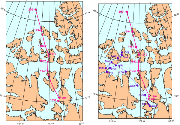
Geological Survey of Canada
The changing location of Earth's North Magnetic Pole in and around the islands of northern Canada. The map of the Magnetic Pole's measured location from 1831 to 2001 is shown on the left. Someone actually went to the magnetic pole in each of the years shown and directly determined the pole's location. The map on the right extends back to 1600 (purple points and lines). The older values of the pole's location are estimates based on compass readings from ships.