Ying-Hwa "Bill" Kuo - Meteorologist
Launching satellites, refining models, and building community
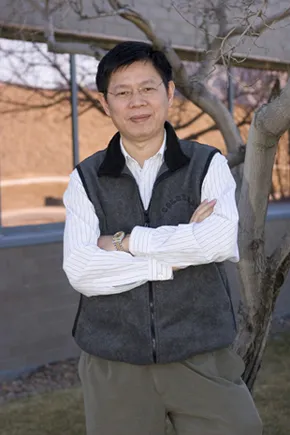
Bill Kuo
Carlye Calvin/UCAR
One morning, six-year-old Ying-Hwa Kuo woke on his family's rice farm in Tai Chung, in west-central Taiwan, to a world transformed.
"I walked out of my house and found that all the fields were filled with gravel, and the farmland was gone," he recalls. A typhoon—the name for hurricanes in the Northwest Pacific—had brought intense rain and flooding. "I was awed by how weather can change everything overnight." His family eventually sold the farm and moved to town, but Ying-Hwa, who goes by "Bill" in the English-speaking world, never forgot that morning.
Decades later, Bill is a meteorologist leading UCAR's deployment of an array of satellites that are providing a wealth of data about the atmosphere. COSMIC, which stands for the Constellation Observing System for Meteorology, Ionosphere, and Climate, is a joint project between the United States and Taiwan (in Taiwan it's called FORMOSAT-3). The system is transforming weather forecasting, climate monitoring, and research on space weather.
COSMIC's six microsatellites, launched in April 2006, track radio signals from the Global Positioning System as they pass through Earth's atmosphere. GPS signals undergo changes in frequency and amplitude when they encounter water vapor or other physical components of the atmosphere. Those changes can be measured using a process called radio occultation. UCAR's COSMIC science team converts the altered signals into useful profiles of humidity and temperature throughout the lower atmosphere. Information about the electrical structure of the upper atmosphere, Earth's gravitational field, and other data is also being extracted. Researchers and forecasters around the world have online access to the resulting wealth of data via the COSMIC Data Analysis and Archive Center.
Bill put aside other research interests to become director of the COSMIC project office in 2000, but he says the lengthy process and complex contract negotiations required to get an international project off the ground have all been worth it.
"At some point there'll be a once-in-a-lifetime opportunity to be able to do something for more than just yourself, to benefit a big community. I'm very lucky to have that," Bill says.
But how did the small boy impressed by typhoon flooding become involved in a satellite mission?

To obtain humidity profiles and other data essential for weather prediction, for decades forecasters depended on weather balloons carrying instruments called radiosondes that are launched twice daily in spots scattered widely across the globe. Hardly any of these "soundings" are launched over the oceans. COSMIC has changed things dramatically by providing about 2,500 sounding profiles each day and almost total coverage of the planet. This map shows the typical locations of a day's worth of COSMIC soundings (green diamonds) compared to radiosonde launch sites (red circles).
Illustration courtesy COSMIC
As a young student, Bill worked hard to get into National Taiwan University (NTU). But he wasn't sure what he wanted to study. There was stiff competition for the popular engineering programs, so to hedge his bets, he listed atmospheric science as an alternate possibility. He was admitted to the brand new department of atmospheric science, but it took a while for meteorology to capture his imagination. The courses seemed dry and full of memorization. "We used to call it 'stuffing the turkey,' " Bill recalls.
Fortunately, a few young professors had other ideas about teaching. The turning point was a course with Professor Ching-Yen Tsay on numerical weather prediction. "I found this fascinating—that you can actually predict the evolution of the weather with computers," Bill recalls. "Then I was hooked."
After graduation in 1976 and two years of obligatory military service, Bill looked abroad for advanced study. He chose the South Dakota School of Mines & Technology, where he finished his master's in 1979. In South Dakota, he also experienced his first snowfall.
For his doctorate, Bill looked for a program where he could focus on typhoons. Richard Anthes (who would later become president of UCAR) was then a professor at the Pennsylvania State University, developing computer models of hurricanes and typhoons, and he offered Bill a student assistantship. But by the time Bill arrived at Penn State in early 1980, Anthes was in the process of transforming the hurricane model into a regional weather model called MM3 (Mesoscale Model, version 3).
"I knew nothing about modeling regional weather," Bill recalls. But he learned quickly and was soon publishing research papers with Anthes and other colleagues. In 1981, when Anthes accepted his first position at NCAR as a division director, he invited Bill to finish his thesis here. For his doctorate, Bill examined how convection—the transfer of heat and moisture through the atmosphere—affects the mesoscale, or regional, environment. "Pretty far from typhoons," Bill notes with a smile. He received his doctorate from Penn State in 1983 and has been with NCAR and UCAR ever since.
As a new NCAR scientist, Bill's main task was refining the MM3, which had been worked on by so many different graduate students over the years that its underlying computer code was a patchwork. The result, MM4, was used for a major study of acid rain. After making the model more user-friendly and adding training and support services, Bill and colleagues then offered MM4 to the scientific community for research use.
With Bill at the helm, the model received another upgrade in the early 1990s to MM5, which quickly found users around the world for both research and forecasting. His expertise next turned to the development of the Weather Research and Forecasting model. Designed to be the next-generation replacement for MM5, WRF (pronounced "worf"), was developed by a multiagency team to serve the needs of both researchers and operational forecasters.
Bill has contributed to many other projects as a member of NCAR's Mesoscale and Microscale Meteorology division. For instance, his interest in modeling and severe storms led to several collaborative studies of how winter storms develop rapidly over the ocean.
From his earliest days at NCAR, Bill has sought opportunities to collaborate with colleagues in Taiwan and to find ways to involve students in research. "It's really gratifying to create opportunities for the younger generation of scientists," he says.
Typhoon Herb, which hit northern Taiwan with a vengeance in August 1996, brought Bill back to his earliest interest. Soon after the storm, he got a phone call from his NTU mentor, Professor Tsay, who was now vice-chair of Taiwan's National Science Council, suggesting it was time to put more energy into typhoon research. Bill agreed, organizing a workshop at NCAR in May 1997 that brought scientists from the United States and Taiwan together to identify key problems in typhoon prediction, including Taiwan's mountainous terrain and the lack of observational data, especially over the surrounding ocean. The need for more data led to discussions of the GPS radio occultation method, and the COSMIC/FORMOSAT-3 project was born soon after.
The satellite project has occupied most of Bill's time ever since. He's enjoying the opportunity to involve students and young scientists from both sides of the Pacific. He's also motivated by the opportunity to provide a cornucopia of much-needed data to the next generation of researchers and operational forecasters around the globe.
The COSMIC mission was reaching the end of its designed five-year lifespan in 2011. Bill and colleagues are awaiting the fate of COSMIC-2. Designed to move from experimental to full operational mode, the new mission is included in NOAA’s fiscal year 2011 budget and is pending action by Congress.
by Zhenya Gallon
March 2006; updated March 2011