Clouds Form Due to Weather Fronts
Did you know that clouds can give you important clues about the weather over the next few days? The presence of certain cloud types can provide clues about the location of weather fronts, which occur when two large masses of air collide at Earth's surface. Different cloud types can be harbingers of the weather headed your way.
Clouds and Cold Fronts
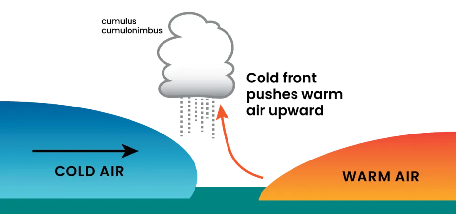
Cold fronts occur when heavy, cold air moves along Earth’s surface and collides with lighter, warm air, pushing it upward. The warm air being pushed upward often forms cumulus clouds. If atmospheric conditions are just right, these cumulus clouds sometimes grow into cumulonimbus clouds, which produce thunderstorms.

As a cold front moves into an area, warmer air ahead of it will be pushed upward forming cumulus or cumulonimbus clouds and possible gusty winds or thunderstorms.
CMMAP, UCAR Center for Science Education
The arrival of the cold front at your location is often marked by gusty winds, a drop in temperature, and possible rain, snow, or thunderstorms. After the front moves through, the air remains cooler and any rain or snow ends. As the cold front moves away, skies are mostly clear, but you might see either stratus or stratocumulus clouds.
Clouds and Warm Fronts
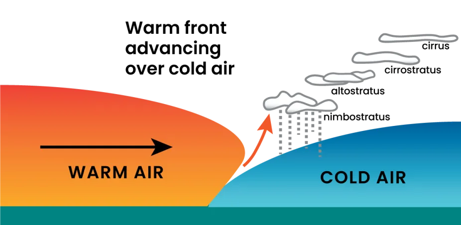
Warm fronts produce clouds when an advancing warm air mass slides above a cold air mass, pushing warm, moist air upward in the atmosphere. Far ahead of the warm front, this upward motion of air can form cirrus clouds. These are followed by cirrostratus clouds as the warm front moves nearer to your area. As the front gets closer, altostratus or low-level stratus clouds develop and rain is possible, usually within the next six or so hours.

A warm front moving into an area pushes warm air upward over colder air. Distinct cloud types form ahead of this front and provide clues about the upcoming weather.
CMMAP, UCAR Center for Science Education
By the time the warm front reaches a location, stratus or nimbostratus clouds and sometimes fog can be present. Rain showers are likely, and if cumulus and cumulonimbus clouds form, thunderstorms can also develop just ahead of and behind the warm front. Once the warm front passes, the air behind it tends to stay warmer and skies will clear.