Weather Forecasts
The weather symbols and types of weather measurements described below are common parts of weather forecast maps.
Warm and Cold Fronts
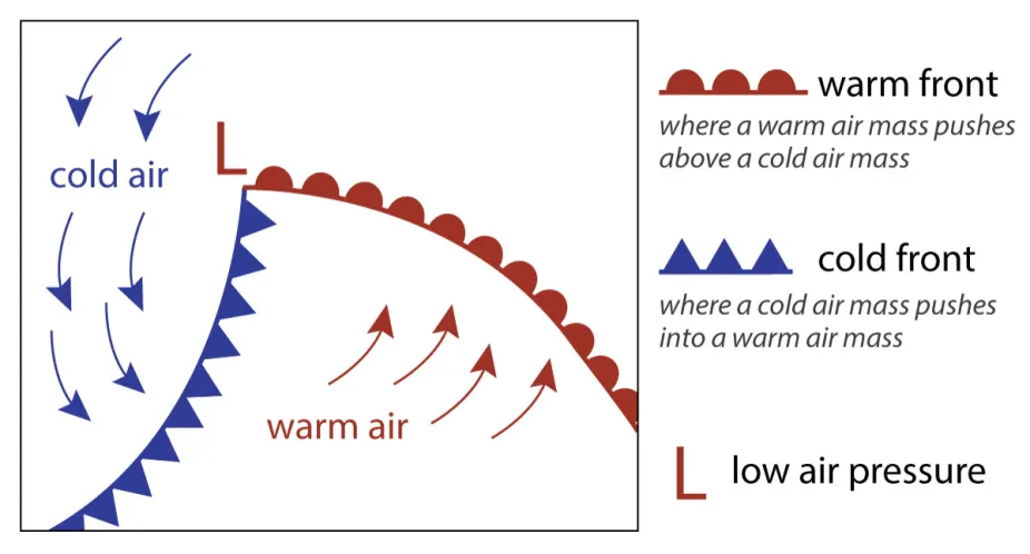
A typical mid-latitude cyclone includes a cold front and warm front with an area of low pressure where they meet.
L.S. Gardiner/UCAR
High and Low Pressure Systems
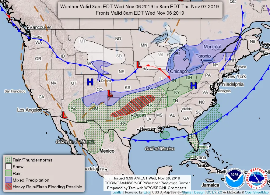
Air pressure affects the weather. Areas of high pressure are usually where weather is calm and sunny. Areas of low pressure can be stormy. Air pressure is indicated on weather maps with a blue "H" at each center of high pressure and a red "L" at each center of low pressure. The most detailed weather maps also include pressure measurements and contour lines that connect areas of equal pressure.
Cloud Cover
Cloud cover can be shown in weather forecasts in different ways. Often clouds are shown in a satellite image of the region. Infrared (IR) satellite images can be used to help identify whether the clouds are high or low in the troposphere. But satellites can only see the clouds from above. Clouds are identified from below at weather stations. Maps of weather station data will represent cloud cover at each station with a circle. The circle is empty if skies are clear. It's filled in with white if the sky is cloudy and half-filled if the sky is partly cloudy. Citizen scientists also make cloud observations which can help with weather forecasting and climate research. For example, citizen scientists using the GLOBE Observer Clouds app make sky observations that get added to a global database.
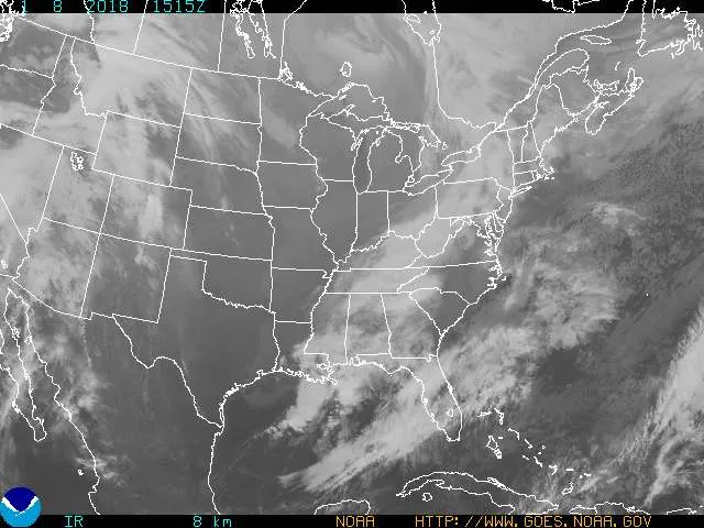
GOES satellite image showing infrared radiation
NOAA
Wind and Wind Direction
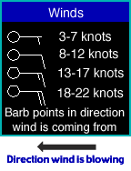
Weather station maps indicate wind direction and speed with little arrows attached to each weather station point. The more barbs at the end of each arrow, and the longer they are, the harder the wind is blowing. Each long barb is 10 knots (about 11.5 miles per hour or 18 kilometers per hour). Each short barb is half that amount. A barb that looks like a triangle is blowing at 50 knots (about 58 mph or 80 kph). The Windy.com map (website and app) shows winds worldwide according to data from several weather models.
Air Temperature
Dew Point
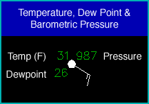
The number to the lower left of each station is the dew point temperature in degrees F (for U.S. maps) or degrees C (for other countries). The dew point is a measure of moisture; it shows how much you'd have to cool the air to get a relative humidity of 100 percent. The higher the dew point, the more water vapor there is for producing rain or snow.
Barometric Pressure
The number to the upper right of each station is the barometric pressure. Since the pressure goes down with altitude, this reading has been adjusted to show the pressure as if the station were at sea level. The typical sea-level pressure is a little bit more than 1000 millibars. (The number is in kilopascals (kPa), which is the same as millibars).
The number has been compressed to fit the map by lopping off the first one or two digits (which are always a "10" or a "9") and omitting the decimal point before the last digit. For example, the code "085" would mean 1008.5 millibars, while 954 would be 995.4 millibars.
On a map of barametric pressure, you'll find lines, called isobars that go around centers of high and low pressure. They connect places with equal barometric pressure, so you can see where the highs and lows are. The wind usually follows the isobars, with a slight trend in the direction of the low pressure area.
© 2019 UCAR