Thunderstorms

A supercell, the largest of all thunderstorms, is likely to spawn tornadoes.
UCAR
Picture a thunderstorm: heavy raindrops beat the roof, lightning flashes through the windows, thunder booms, the dog whines from his hiding spot under your bed. Now picture two thousand thunderstorms!
Right now, at this very moment, there are about two thousand thunderstorms going on around the world. Even though thunderstorms are common, they are still dramatic events with intense rain, hail, wind, lightning, thunder, and even tornadoes.
Thunderstorms form when warm, moist air rises into cold air. The warm air becomes cooler, which causes moisture, called water vapor, to form small water droplets — a process called condensation. The cooled air drops lower in the atmosphere, warms, and rises again. This circuit of rising and falling air is called a convection cell. If this happens a small amount, a cloud will form. If this happens with large amounts of air and moisture, a thunderstorm can form.
Thunderstorm Anatomy
Thunderstorms can consist of just one convection cell, multiple convection cells, or even one extremely large and powerful convection cell. Below is a description of three types of thunderstorms, classified by their structure: single-cell, multi-cell, and supercell.
- Single-cell thunderstorms: Thunderstorms created by just one convection cell in the atmosphere are called single-cell storms. Most of these are small, lasting only about an hour, and are also called ordinary thunderstorms. These storms often form during summer and include towering cumulonimbus clouds that can grow 12 kilometers (7.5 miles) high in the atmosphere. Rain and lightning are common. Sometimes hail falls.
- Multi-cell thunderstorms: Some thunderstorms are made from many convection cells moving as a single unit. These are called multi-cell thunderstorms. Often the convection cells are arranged as a cluster, with each cell at a different stage of the thunderstorm cycle. Multi-cell storms along a cold or warm front, where warm air is pushed high into the atmosphere above cold air, often form a line, called a squall line. The squall line can be up to 1000 km (600 miles) long. Strong wind gusts often blow just ahead of the storm.
- Supercell thunderstorms: Thunderstorms with deep, rotating updraft winds, called supercells, are very large and last for hours releasing huge amounts of rain and sometimes even baseball-sized hail. They include fast moving convection – air zooming upward at as much as 280 kilometers (175 miles) per hour. Rotation in supercells sometimes forms violent tornadoes, the largest and most damaging type, because the storms are so long-lived. Several tornadoes can be produced from one supercell thunderstorm. Supercell clouds grow up to 18 km (11 miles) high in the atmosphere, right up to the bottom of the stratosphere. Supercells are the least common type of thunderstorm, but they are the most destructive.
Where Air Rises to Form a Thunderstorm
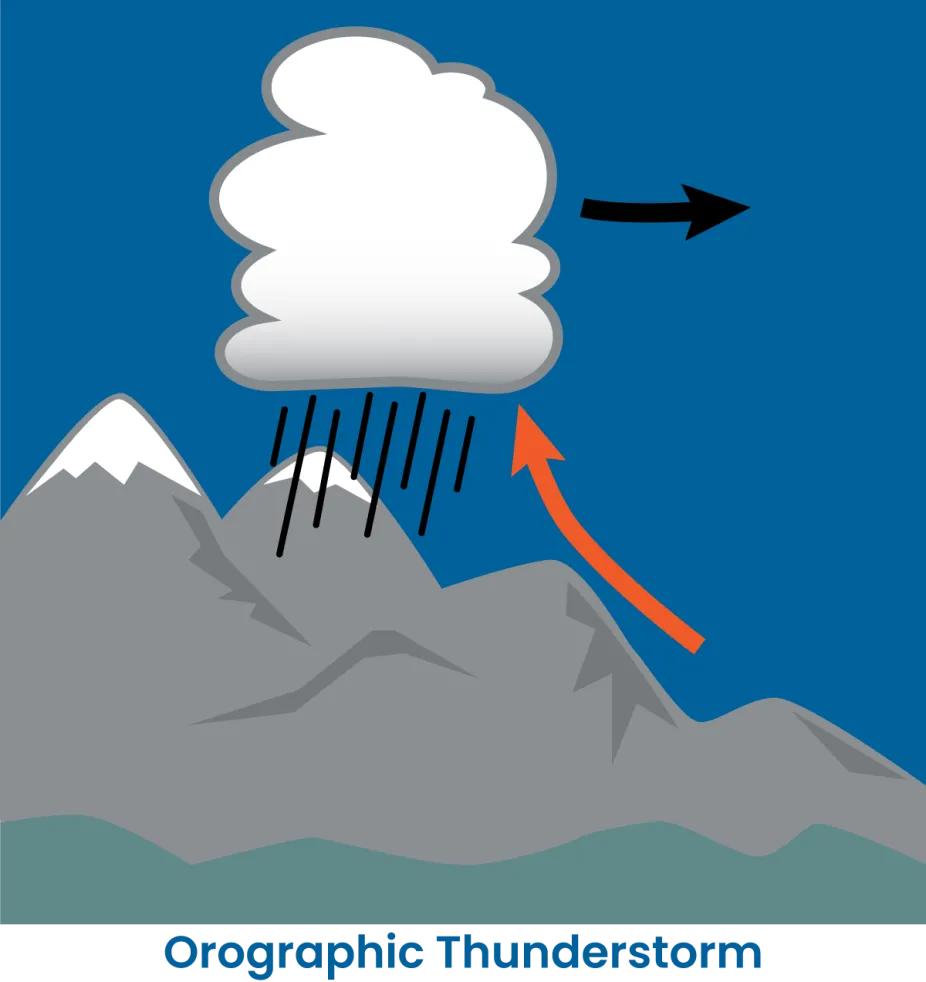
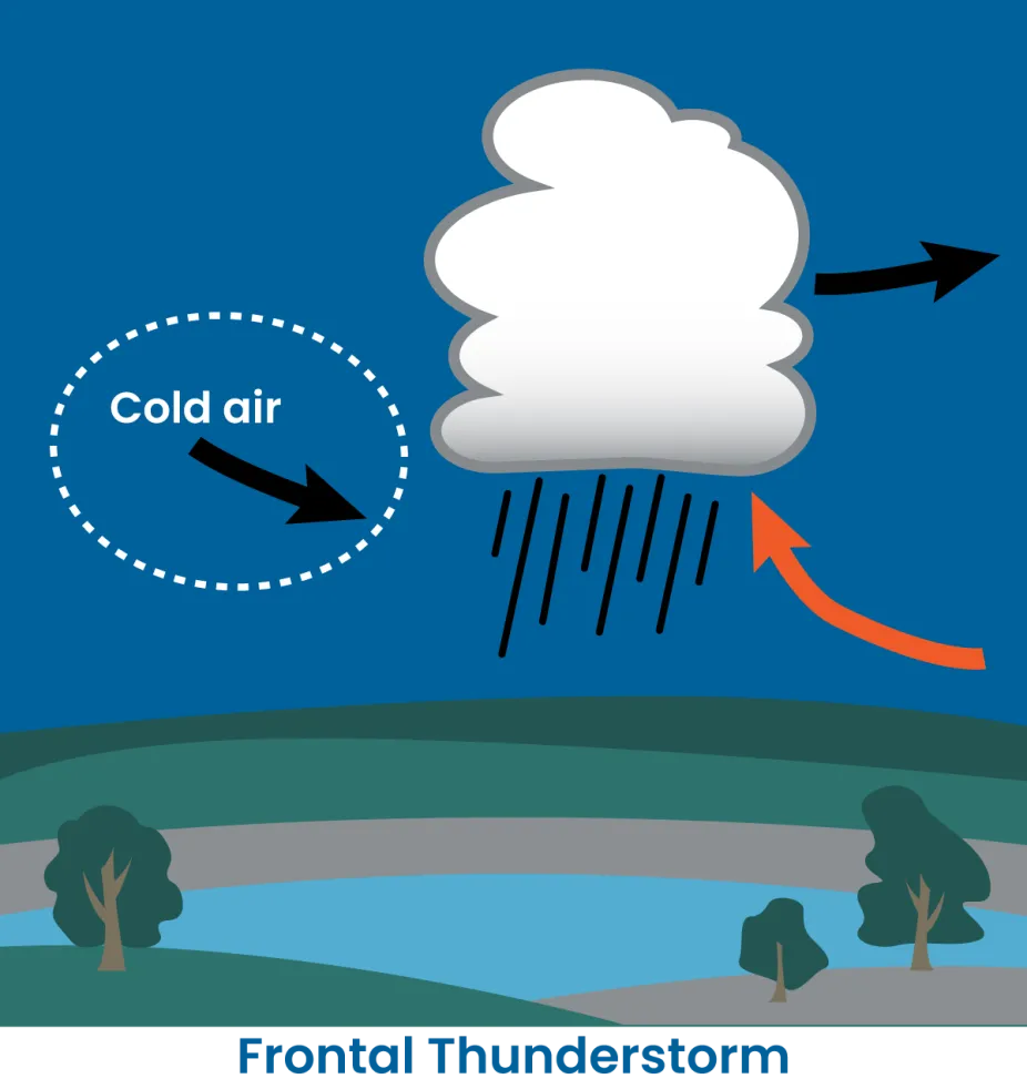
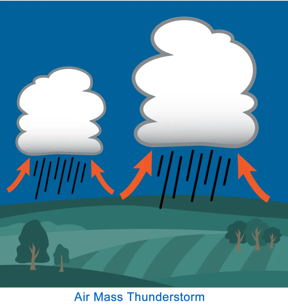
All thunderstorms begin with air rising into the atmosphere to form a convection cell, but the air can be lifted in different ways. Another way to classify thunderstorms is by the location where they form and the reason the air rises. The pictures below describe three different ways that lifting of air can begin as the first step to setting up a thunderstorm.
Orographic thunderstorm
These thunderstorms form due to lifting of air by a mountain or hillside.

Orographic thunderstorms form when air is forced up by a mountain or hillside.
UCAR Center for Science Education
Frontal thunderstorm
Frontal thunderstorms are caused by the upward lifting of air along a storm front.

Frontal thunderstorms can occur along the boundary of a weather front (e.g., a cold front).
UCAR Center for Science Education
Air mass thunderstorm
Air mass thunderstorms form when warmer, wetter air within an air mass is lifted upward.

Air mass thunderstorms develop from local-scale upward motions of air in an unstable air mass, where warmer, wetter air is lifted upward.
UCAR Center for Science Education